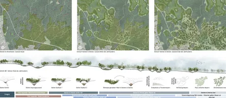
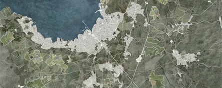
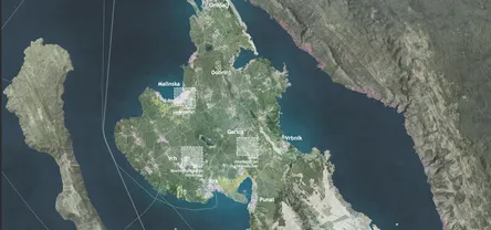
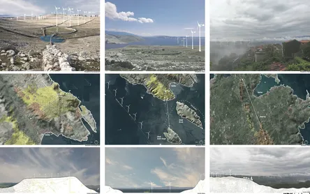
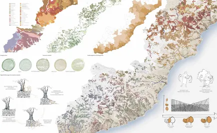
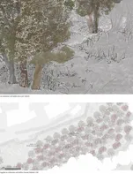
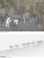
"Water-(sponge)-scape – An Update of the Water Reservoir for Krk" addresses the challenges of climate change on the Croatian island Krk. The focus is on extreme weather events such as prolonged dry periods, heavy rainfall, and their consequences like flooding and crop losses. The aim of the work is to develop innovative landscape strategies that increase the island's resilience to these climatic changes. Can ways be found to delay, buffer, and subsequently store rainfall runoff to create a comprehensive water storage and distribution network? What natural structures on the island of Krk can be utilized to stabilize the water balance and respond to various climate scenarios?
As part of the analysis, climatic data were evaluated and local conditions were examined, including the island's characteristic karst landscape, agriculture, and the impact of tourism on the water balance. Building on these findings, the concept of the "Water-(sponge)-scape" was developed. This concept proposes to revive and further develop the natural structure of dolines on the island as buffer zones to delay runoff and store rainwater, among other "tools."
The study shows that the targeted use of dolines, supplemented by modern green roof systems and urban water solutions, represents an effective strategy to prevent flooding from heavy rainfall and drought. A structured network of dolines, retention (drystone) walls, and other measures can significantly increase the island's water retention capacity and improve its resilience to climatic extreme events. Local conditions and geomorphological structures are modernly adapted to achieve ecological, social, and economic benefits and to prepare the island of Krk for future challenges.
The aim of this thesis is to clarify the landscape and sociocultural impacts that the Croatian island of Krk is experiencing due to the high and continuously increasing volume of tourism. Additionally, it aims to investigate how these impacts can be managed and planned for in a forward-looking manner to productively utilize the landscape in accordance with its potential and rich traditions. To address these questions, a tourist survey and scientific research in specialized literature were conducted, along with two interviews with local residents and several days of site inspections in the project area to gain an understanding of the local landscape.
The research revealed that the island of Krk, especially the Malinska area, faces significant challenges due to the extreme visitor pressure during the tourism season. The focus of the local population on tourism and the sharp increase in population during this period have led to the conversion of agricultural land into holiday accommodations. The subdivision of land and the small size of plots make profitable agriculture difficult, leading to the sale of land to investors to capitalize on tourism. This results in landscape and sociocultural changes whose temporality, in terms of cyclical occurrences, moves in opposite directions.
The developed draft indicates that the temporal shift of the landscape and the inhabitants of Krk, derived from the analysis, presents both challenges and opportunities. A concept for year-round and gentle tourism that meets the new travel demands of European tourists can harmonize the productivity and use of the landscape with the needs of residents and visitors, thus doing justice to the rich traditions and potential of the Krk landscape.
Vincent Richter
2024
SelbstKRKsamkeitsLANDSCHAFT
Land use strategy for the common good as a basis for the preservation of the cultural landscape and intangible cultural heritage on the island of Krk
The loss of cultural landscapes is a cross-regional problem that is particularly noticeable on the island of Krk. The once intensively farmed landscape has given way to a historical dependency on tourism. This shift has led to former agricultural structures being overgrown by forests and the loss of intangible assets, especially the sense of community. Therefore, protecting and preserving the cultural landscape, intangible cultural heritage, and the common good are central goals of this work. The thesis addresses the question: How can the structural, material, and immaterial qualities of the island of Krk be utilized to develop a community-oriented land-use strategy that contributes to the preservation of the cultural landscape and intangible cultural heritage?
The preservation of the cultural landscape and intangible heritage on the island of Krk can only be ensured in the interest of the common good by recognizing, overlaying, and activating the structures and qualities of the landscape and the involved stakeholders. Together with a caricatured division of the residents into four stakeholder groups, the structural and immaterial qualities of the landscapes and associated stakeholders were identified and abstracted. Three examples visually represent the resulting qualities. By linking the stakeholders, their structures, and associated landscapes, self-efficacy is strengthened, and consequently, the island community is reactivated. This leads to proposals for sustainable landscape use that align with the needs of the residents in the interest of the common good.
Andreas Pratscher
2024
ener KRK ic island. Krk as a model for the cooperative and landscape-friendly integration of renewable energies in the Mediterranean region
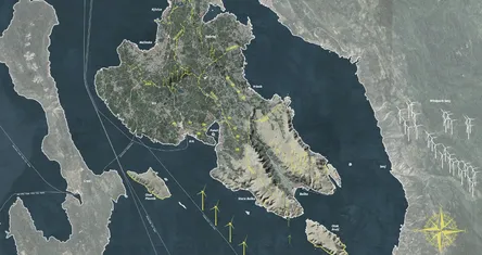
This bachelor's thesis examines the integration of renewable energy into the cultural landscape of the island of Krk, located in the northern Croatian Adriatic. Motivated by the perspectives of local residents who feel marginalized due to the island's strong focus on tourism, this work analyzes the landscape typologies of Krk, the historical and economic development of the landscape and society, as well as the impacts of climate change. The emphasis is on the potential for wind and solar energy.
The hypothesis posits that the establishment of energy cooperatives on Krk will strengthen the residents' sense of responsibility and identification with their island, while simultaneously adding an economic pillar to reduce the economic dependency on the tourism sector. The research employs a multi-method approach, including geographical analyses, cluster analyses, and the aesthetic integration of renewable energy systems.
The primary landscape units, such as the karst landscape, coastal and marine areas, and the forest hinterland, are analyzed for their suitability for various types of renewable energy installations. Special attention is given to the aesthetic integration of these installations to avoid visual overload and to preserve the island's cultural heritage. The key findings demonstrate realistic and representative possibilities for the integration of wind and solar energy, supported by the favorable climatic conditions on Krk. The project aims to provide a model for sustainable landscape development that harmonizes economic benefits with the preservation of local culture and identity, positioning Krk as a pioneer in the Mediterranean region.
Dry stone walls shape the rich heritage of cultural landscapes in the Mediterranean region. With the abandonment of traditional land use, they are neglected and lose significance. This thesis investigates the future role of dry stone walls in the landscape and how they can be preserved as cultural heritage while supporting the sustainable development of cultural landscapes. The aim was to examine the walls in terms of their diverse structures, traditional uses, and qualities from today's perspective and subsequently seek strategies and tools for their protection and valorization. The Croatian island of Krk served as the research area. It was assumed that dry stone walls are more than relics of the past and can contribute to the sustainable development of the island as adaptable, multifunctional structures. The main method was literature review, supplemented by GIS analysis and personal explorations of the landscape on-site. The analysis of several strategies at the European and international levels and the comparison of three selected case studies concluded that a strategy which combines the cultural value of the walls with their potential for sustainable development, thereby giving them new functions, is the most effective way to preserve them on Krk.
As part of the constant growth of the city of Munich, the new district of Freiham is being developed in the west. In addition to housing, workplaces, shopping facilities and an educational campus, a new landscape park is being created and a bathing lake is planned. The surrounding landscape of Munich is also under pressure to change, and a transformation of the landscape from an ecological, economic and social point of view is essential for a future-orientated cultural landscape.
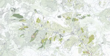
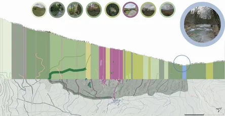
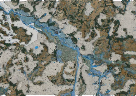
The work deals with this transformation of the landscape in terms of adapting to the effects of climate change. The aim is to create a landscape that simultaneously offers recreational space for people and nature, continues to guarantee high agricultural productivity and implements energy transition and climate neutrality measures. Transforming the landscape while taking ecological, economic and social demands into account is a balancing act. It requires a concept adapted to the landscape that combines ‘blue, green and grey’ elements. Blue elements refer to water management measures for cultivation and heavy rainfall events. Sponge elements store water, slow down runoff and act as carbon dioxide sinks. Green structures in the form of paludicultures or biotope areas as well as renewable energy technologies as grey elements complete this water culture landscape. Starting from the new district of Freiham, a transect through the region west of Munich to the Ampermoos nature reserve is analysed. The transect captures the different facets of the cultural landscape and represents a gradient between city and nature, which makes the development of GRAD-transect in the cultural water landscape interesting.
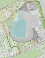
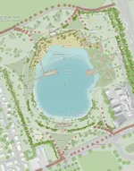
́prozesSEE - rise of the Freiham swimming lake` deals with the processual development of the Freihamer swimming lake by designing the bathing lake out of the area. In the hot summer months, people in urban centres such as Munich look for a way to cool down from the heat of the densely populated city. The need to cool off in the surrounding rivers and lakes is increasing, particularly due to rising temperatures as a result of climate change. However, these options are very limited in the city of Munich. Residents often have to travel long distances to the surrounding districts, such as Lake Starnberg or Lake Ammersee.
The district of Aubing - Lochhausen - Langwied in Munich will be further developed in the coming years due to the continued growth of the Freiham residential area. This includes a residential neighbourhood for around 20,000 new residents. The higher density in this district will create an increased need for new local open spaces. A nearby area is suitable for gravel extraction and can therefore be developed as a bathing lake for the new residents in the future. As the completion of the bathing lake is expected to take 15 years, it is important to make the process of gravel extraction a tangible experience for local residents. The development up to the completion of the Freihamer swimming lake should be visible so that visitors can already use the area as a local recreation area and, over time, identify with the bathing lake and experience its development.
Due to its morphology, the region of Liguria in Italy is particularly susceptible to geohazards such as rockfalls, slope deformations and landslides. The change in water availability has made georisks a social risk for the region, especially in the hilly areas. Another general problem is the lack of interconnected water systems, which leads to dependence on individually collected water in dry periods and a lack of communal water catchment systems during heavy rainfall. Based on these closely related fundamental problems, a concept for the future management of water and geohazards was developed. The focus here was on protecting human life and infrastructure.
The concept is based on the direction of water flow and mass movement - from hill to valley, from top to bottom. It is based on the principle of terraced landscape ownership, in which everyone is responsible for the wall of their land. The design focuses on the settlement of Ville San Pietro, which was built on a landslide area with the highest risk of danger. The design uses engineering and landscape architecture tools adapted to the specific characteristics of the landscape. The result is a sequence of different areas in which the georisks and water issues are constantly being addressed in new ways. By directing, buffering and slowing down the water, the aim is to reduce the risk as far upstream as possible. Slope-stabilising vegetation strips are integrated to protect the infrastructure from slipping road slopes. Visualising geohazards will help to strengthen society's sense of responsibility for common risks.
Since the 20th century, the region of western Liguria has been experiencing a constant demographic decline, which is visible in the cultivation and maintenance of the historical landscape. Fallen dry stone walls and the resulting hillside erosion clearly characterise the landscape in the mountain regions. In contrast, the coastal region is dominated by tourism and urbanisation. The terraced, high-maintenance landscape of Liguria is the historical image of a history rich in population, in which terracing is the foundation for people to live and cultivate in this landscape.
The Ligurian landscape is analysed in the context of Tim Ingold's theoretical approach to landscape. The focus here is on the interaction between human activity and the morphology of the landscape. Ingold's perspective emphasises the importance of understanding the relationship between humans and the environment as a dynamic and ongoing process of human activity. In the context of activity, not only the environment in which people are working is relevant, but also the interaction between people and materials in general. Conceptually, the landscape-defining structure of the dry stone wall is seen as a grown structure, which means that man and material are equally involved in the shaping process. The concept of active LANDSCAPE complements this process with the material of vegetation. The aim is to find a long-term form of landscape in which human activity is no longer an essential part of the slope stabilising structure. This process is divided into the following periods: initiating and fragile, observing and growing, and the long-term form of the landscape: abandoned and stable. At the local level, based on an understanding of the geomorphology of Liguria and the potential of vegetation, the work presents two exemplary designs. The linearity of the fasce della Liguria becomes a dosso per l ́ulivieta, an olive grove characterised by hills, south of Villatalla. In the Savona region, the terrazze velate design covers the terrace with a veil of vegetation. New forms of the grown structure consolidate the slope and characterise (locally) specific landscapes.
Unter politischem und sozialem Druck wird die Infrastruktur Erneuerbarer Energien immer weiter entwickelt und ausgebaut. Besonders die Energieproduktion mithilfe solarer Energie erfährt einen großen Aufschwung. Auf Flächen, wo die Natur schon zu verloren scheint, darf gewirtschaftet, ein Solarpark errichtet werden und der Mensch sich erholen. Monofunktionale und getrennte Flächennutzungen werden in Zukunft aber den Bedarf an Wirtschaftlichkeit und Lebensraum nicht mehr tragen können, denn die nutzbaren Flächen werden knapp, in Deutschland, als auch global. Die strikte Flächentrennung von Erholung, Ökonomie und Naturschutz vermittelt der Bevölkerung das Bild einer unangetasteten ‚Urnatur‘, die es zu bewahren gilt. Das hat zur Folge, dass jegliche Transformation der Landschaft auf Widerstand stößt. Um das Ziel des Koalitionsvertrags der deutschen Regierung bezüglich des Ausbaus der Solarenergie zu erreichen, muss der Bestand um den Faktor vier erhöht werden. Aus der Problemstellung geht hervor, dass eine Transformation der Landschaft notwendig ist, um den Zielen der Energiefrage gerecht zu werden.
Der Entwurf solIDarLANDSCHAFT führt mit den Tools zu einer Vielzahl an positiven Synergieeffekten. Der Moorschutz kann durch eine Kooperation zwischen der Moorrenaturierung und Photovoltaik-Freiflächenanlagen erfolgen. Statt dem ökonomischen Nutzen des Niedermoors als Ackerland oder Grünland, ist die Produktion von solarer Energie ein nachhaltiger Wirtschaftszweig, zusätzlich zu der standortgerechten landwirtschaftlichen Tätigkeit der Paludikultur und der Etablierung von Erlenniederwäldern. Die wiederkehrende Wertschätzung des Moors in der Region des Havellands in Verbindung einer zukunftsfähigen Struktur kann die regionale Identität der Bewohner*innen stärken. Die Winderosion auf Äckern kann mittels des Wind-PV reduziert werden. Die Ernteerträge der Landwirt*innen sind langfristig geschützt, da sie vor den extremen Witterungseinflüssen des Klimawandels abgeschirmt werden.
Seit Anfang-Mitte des 20. Jahrhunderts hat vor allem durch die Industrialisierung ein sozialer und demografischer Wandel stattgefunden. Städte gewinnen immer mehr an Wichtigkeit und erleben Zuwanderung und Wachstum. Ländliche Gebiete sind von Abwanderung oder Landflucht geprägt, wodurch eine landschaftliche Transformation des Raumes bedingt wird. Allgemein betrachtet gewinnt durch das Wachsen und Schrumpfen von Städten und ländlichen Ortschaften der Zwischenraum beider Räume an Relevanz. Das Problem besteht allerdings, dass vor allem bei ländlichen Entwicklungen zwischen Land und Stadt solche Zwischenräume oder Übergangsgebiete meistens übersehen werden (Flamm & Becker, 2015). Deren Identität steht momentan in dem Hintergrund. Es stellt sich folglich die Frage: Kann durch ein regionales Landschaftsentwicklungskonzept die Identität der Übergangsgebiete gestärkt werden und eine zwischenräumliche Vermittlung geschaffen werden?
Das Ziel dieser Bachelorarbeit ist es, sich mit Elementen der sozialräumlichen Strukturen der markLANDSCHAFTEN auseinanderzusetzen, insbesondere mit jenen der drei identifizierten Raumeinheiten und deren zwei Übergangsgebiete. Zur Angehensweise der Arbeit wird Martina Löws sozialräumliche Theorie und Lösungsansatz der Eigenlogik untersucht.
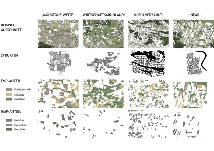
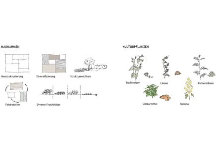
Mit einer konstant wachsenden Weltbevölkerung und dem damit einhergehenden steigenden Bedarf an Nahrungsmitteln, stellt sich immer dringender die Frage, wie die zur Verfügung stehenden Flächen am besten genutzt werden sollten, damit auch zukünftig die weltweite Ernährungssicherheit gewährleistet werden kann. Fläche und Boden sind jedoch endliche Ressourcen und nicht unbegrenzt nutzbar. Es bedarf Handlungskonzepte auf lokaler und regionaler Ebene, um - aufaddiert - eine Lösungsstrategie für die so vielschichtige und bedeutsame Thematik der weltweiten Ernährungssicherheit darzustellen. Wie Schlüsselansätze für die globale Ernährungs- und Landnutzungsproblematik auf regionaler und lokaler Ebene aussehen könnten, soll Gegenstand dieser Arbeit sein. Als Prämisse gilt dabei folgende These: Nur mittels einer tiefgreifenden Umstrukturierung der Agrarproduktion durch eine um 50% reduzierte Viehwirtschaft und unter dem Aspekt der Multifunktionalität und Diversifizierung auf regionaler Ebene kann die globale Ernährungssicherheit nachhaltig gewährleistet werden, sowie ist es möglich gleichzeitig ökologische Probleme maßgeblich zu mildern und den ländlichen Raum lokal zu stärken. Diese These wird im Gebiet der Marklandschaften im Dreiländereck Brandenburg/Sachsen-Anhalt/Niedersachsen als eine Art „Vorreiterrolle“ untersucht, da hier eine hochagrarindustrielle Landwirtschaft und die flächenkostspielige Viehwirtschaft durch die hohe Futtermittelproduktion prävalent ist.
Als Leitidee für diese Arbeit fungiert die in der 2021 veröffentlichten Greenpeace e.V. Studie ‚Landwirtschaft auf dem Weg zum Klimaziel‘ postulierte Prognose, dass bis 2045 die Tierbestände um die Hälfte reduziert werden müssen, um die Klimaziele in der Landwirtschaft in Deutschland zu erreichen. Als Methoden innerhalb des Konzepts kommen das Prinzip der Differenzierten Landnutzung nach Wolfgang Haber und der nach WBGU zukunftsfähige Lösungsansatz der Multifunktionalität innerhalb der Landnutzung zum Tragen. Als unterstützende Instanz zur methodischen Arbeit in Konzept und Entwurf wurde das Referenzprojekt ‚Kannawurf 1.500 Hektar Zukunft - Klima-Kultur-Landwirtschaft: Erprobung einer klimagerechten, kooperativen Land(wirt) schaft‘ herangezogen, interpretiert und hilfreiche Grundlagen in die eigene Arbeit hinsichtlich Thematik, Räume und Maßstäbe übersetzt.
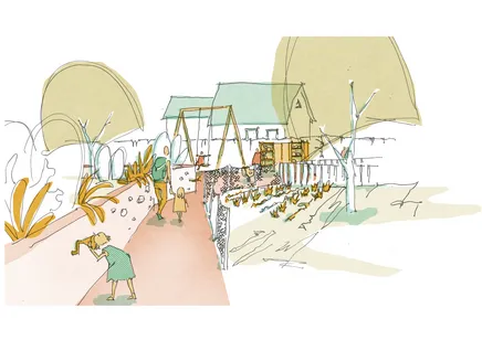
Diese Arbeit beschäftigt sich mit zwei schmalen Wegetypen – einerseits mit den Ruelles Montreals als lebendige, offene und kosmopolitische Orte und andererseits mit den Pädchen in Moselorten, die trotz vieler Ähnlichkeiten zu den Ruelles heute in Vergessenheit geraten und kaum genutzt werden.
Dabei wurden über eine Clusteranalyse anhand von Interviews acht Aktivitäten und Strukturelemente identifiziert, die zur Offenheit der Ruelles beitragen. Die meisten der ermittelten Aktivitäten und Strukturelemente fördern die Offenheit der Ruelles, indem sie auf verschiedene Weise Kommunikation und Interaktion ermöglichen beziehungsweise provozieren. Als Ergebnis liegt für jeden Pädchen-Typen ein Konzept zur Umgestaltung hin zu einem offenen, kosmopolitischen Raum vor, das auf den Qualitäten der Ruelles aufbaut, aber eng auf den jeweiligen Raum zugeschnitten ist. Anhand dieser fünf Konzepte sollen sich die Pädchen – wenngleich sie nicht in der bunten Kultur-Metropole Montreal liegen, sondern im ruhigeren Moseltal – zu Orten der Neugierde, der Kommunikation und der Gemeinschaft entwickeln.
Im Rahmen einer Internationalen Bauausstellung (IBA) soll ein Entwurfskonzept entwickelt werden, das den ländlichen Raum überdenkt und die Landschaft in den Vordergrund stellt. Es zeigt sich, dass insbesondere durch Zentralisierungsprozesse, also der starken Konzentration auf bestimmte Ballungszentren, andere Regionen “abgehängt werden” und dadurch vor die Herausforderung einer räumlichen oder sozialen Fragmentierung und Homogenisierung, beispielsweise der einseitigen Milieubildung, gestellt werden. Die Arbeit bezieht sich insbesondere auf den Begriff der Ausdifferenzierung des Soziologen Henri Lefèbvre, der danach Räume der sozialen Interaktion definiert.
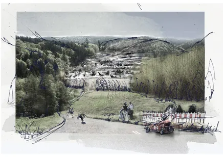
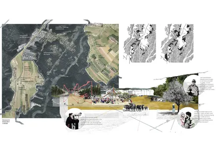
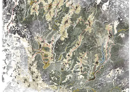
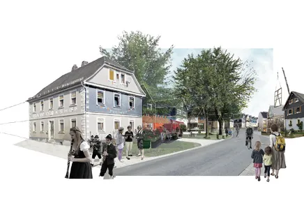
Im Zuge der Globalisierung kam es zu einer Annäherung ehemals isolierter Räume. Alles ist verknüpft und steht in ständigem Austausch und in Beziehung. So viele Vorteile diese Entwicklung auf der einen Seite bringt, resultiert daraus gleichzeitig eine Orientierungslosigkeit und eine erschwerte Integration in die diversen Auswahlmöglichkeiten und Räume. Das Individuum löst sich aus bestehenden traditionellen sozialen Zusammenhängen heraus, womit ein Verlust an Verantwortung für die Umwelt einhergeht. Gerade in ländlichen Regionen, in denen die Bevölkerung abwandert um dem Bedürfnis nach gesteigerten Lebensstilen nachzukommen, entsteht dadurch ein bedrohliches Defizit an sozialer Interaktion sowohl von Mensch zu Mensch als auch von Mensch zu Umwelt. Die sinnhafte Beziehung der Elemente zueinander ist gestört. Die vorliegende Arbeit beschäftigt sich mit der möglichen Entwicklung des Frankenwaldes als Prototyp einer Region, die heute aus der überregionalen Wahrnehmung herausgefallen ist und an Bedeutung verloren hat. Um als gleichwertiger Partner in einem großen Kontext bestehen zu können, muss sie im Inneren wieder eine Relationenbildung ermöglichen, die einen Zusammenhalt über dynamische, zyklische Prozesse hinweg garantiert. Aus Beobachtungen zum öffentlichen Raum in der Stadt und der Bedürfnistheorie nach Maslow wurden die drei elementaren Raumparameter Orientierung, Zugänglichkeit und Möglichkeit abgeleitet, mithilfe derer, permanente Strukturen zur sozialen Interaktion im Raum gestärkt, sowie dynamische Prozesse zur Mitgestaltung über die Zeit angeregt werden sollen. Die Konzeption versucht dadurch das Projektgebiet als charakteristisches Element im Gesamtsystem einer gesteigerten Bedeutung zuzuführen. In der Kohärenz von starkem Raum und starken Akteuren soll ein sinnhafter Wandel unterstützt werden und so dem Frankenwald – als Vorbild für andere, aus sinnhafter Beziehung gefallene Regionen – eine mögliche Zukunftsperspektive zu bieten. Als Instrument wird eine Internationalen Bauausstellung herangezogen, da durch diese einerseits richtungsweisende Grundregeln vorgedacht werden können, gleichzeitig aber die Offenheit für Innovation und Unerwartetes im Ausstellungsprozess gegeben bleibt.
Permanence of historic structures and their advantages in the context of regional development are the main topic of this paper. Through planning an IBA (International Building Exhibition) in the rural and remote region of the Frankenwald problems of remote regions in Germany in general and problems of our globalized and individualized society are shown. As an IBA challenges current habits and perceptions it tries to give answers to the important questions of our time: How can we live on an ever smaller earth – regarding the relation between population size and resources of one ‘green planet’? How can we transform landscapes from frozen-in-time villages like the Frankenwald into sustainable landscapes, that are resilient to the changes of today and the future, climate-wise as well as demographically and economically? All the while not losing their characteristics in the rapid unifying process of globalisation. This paper presents means to tackle these problems through the historically grown permanent structures of a landscape. Thus enabling the people living in their landscape to experience it in a new way, to again relate to it, to re-understand its ways. Permanent structures are not seen as an obstacle to change, but as an opportunity to harness century-old knowledge of a sustainable and low-energy land use. This is achieved through the combination of these withstanding, multi-usable structures with innovative technologies and knowledge from all over the world. How this could look like is shown in a regional design in the scales of 1:25.000 and 1:2.500.
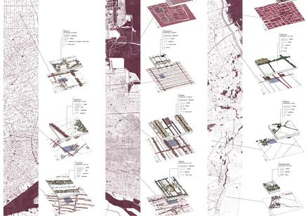
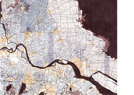
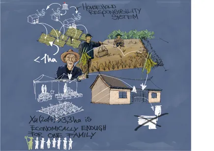
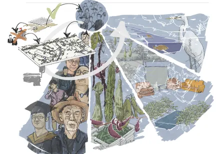
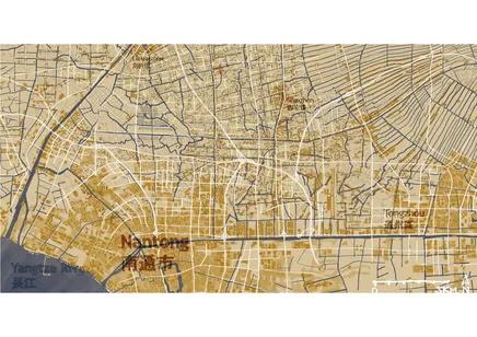
In der vorliegenden Bachelorarbeit wird für ein Kulturlandschaftstyp nördlich von Nantong, Jiangsu eine umfassende Homogenisierung des ländlichen Raums und des ländlichen Lebens festgestellt. Die Kulturlandschaft wandelt sich von der durch das Haushaltsverantwortlichkeitssystem hervorgebrachten kleinbäuerlichen Struktur in eine industrielle Agrarlandschaft. Das kleinbäuerliche Leben auf dem Land wird durch homogene Lebensstile in neuen Hochhaussiedlungen ersetzt. In dieser Arbeit wird infrage gestellt, ob diese Trends in der Lage sind, a) unterschiedliche Lebensstile, b) ein spezifisches und freies Landschaftserlebnis, c) eine Landschaft mit sozialem Gebrauchswert und d) eine Produktvielfalt in der Nahrungsmittelproduktion zu gewährleisten, beziehungsweise zu erhalten. Die Arbeit sieht den eingeschlagenen und von Zwängen geprägten Weg zur Entwicklung des ländlichen Raumes sehr kritisch und versucht, diesem eine ungezwungenere Alternative entgegenzusetzen. Dafür wird vorgeschlagen, die Einführung moderner und großlächiger Landwirtschaft künftig über die Bürger vor Ort und nicht mehr über (Regierungs-)Institutionen oder externe Unternehmen durchzuführen. Da das starre Haushaltsverantwortlichkeitssystem ein Hindernis dafür darstellt, wird vorgeschlagen landwirtschaftliche Genossenschaften als Alternative dazu anzubieten. Für die Einführung der industriellen Landwirtschaft in die Kulturlandschaft und das Reduzieren von Kanal- und Siedlungsstrukturen werden Richtlinien auf Grundlage von ästhetischen Richtlinien propagiert. Diese Richtlinien werden aufgrund von Blickbeziehungen in der Kulturlandschaft hergestellt, die im ersten Teil der Arbeit analysiert werden. Am Ende werden sechs fiktive Beispielcharaktere vorgestellt, welche die Bandbreite der möglichen Lebensstile in der Kulturlandschaft repräsentieren.

